Michael Macleod doesn't just recount a failed infrastructure project; he exposes a terrifying moment when the entire political and academic establishment of London agreed to erase the city's soul for the sake of the private automobile. By synthesizing two decades of archival research into a single, comprehensive map, Macleod reveals that the London we know today exists only because a specific, fragile coalition of residents and politicians managed to stop a plan that would have turned the capital into a concrete Los Angeles. This is not merely nostalgia; it is a warning about how quickly "logical" solutions can become historical nightmares.
The Consensus of Destruction
The piece's most unsettling revelation is the sheer unanimity behind the Ringways plan. Macleod notes that in the 1960s, there was "cross-party political support and an academic consensus behind the plan — and even, initially, strong public support for road building." The prevailing logic was that the city had to adapt to the car, not the other way around. Macleod captures the scale of this delusion perfectly: "They all thought they were saving London, that there was a looming catastrophe and they could save the city."
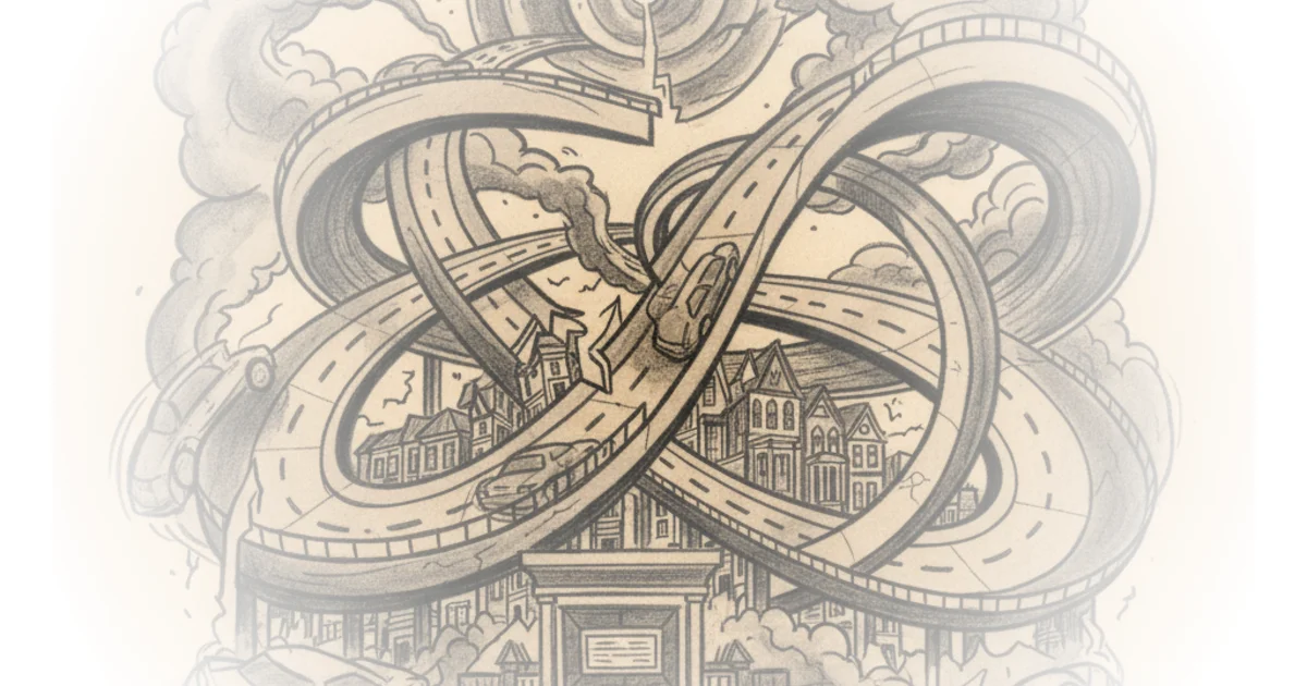
This framing is crucial because it dismantles the idea that such destructive planning was the result of a few rogue officials. It was a systemic failure of imagination. The plan involved obliterating vast swathes of Victorian housing and public parks, viewing them as "life-expired slums" rather than communities. Chris Marshall, the cartographer whose work anchors the article, describes the project as "the most astonishing and destructive thing never to happen to London." The horror lies in the fact that the planners were not ignoring the cost; they were actively calculating it as a necessary evil.
"Everything you know and picture when you think about Camden would not be there. All the things that make Camden what it is today would never have existed."
The argument here is effective because it forces the reader to confront the fragility of their own environment. We assume our neighborhoods are permanent, but as Macleod illustrates, a different political wind could have turned Camden Market into a twelve-lane interchange. This echoes the fate of other British cities; while London narrowly escaped total motorway domination, Glasgow and Birmingham did not, ripping up their city centers to build urban motorways that still scar their landscapes today.
The American Import That Didn't Fit
Macleod identifies a critical flaw in the Ringways logic: the blind importation of American urban planning models into a historic, dense British context. The designers looked at Detroit and Chicago and decided to replicate their solutions of "blasting giant roads through suburbs and urban centres." Marshall points out the fatal disconnect: "What works in Detroit or Chicago really doesn't work in a historic, densely packed British city like London."
The author effectively uses the physical remnants of the plan to prove the point. The Westway, a massive elevated motorway built in the late 1960s, still looms over West London, casting a shadow on the terraces below. Macleod writes, "It's not for nothing the Westway is this massive feature of music and culture that's come out of West London ever since... it's inescapable." The infrastructure that was meant to solve congestion instead created a physical barrier that divided communities and created a permanent, noisy scar.
Critics might argue that the congestion of the 1960s was a genuine crisis that required bold action, and that without the Ringways, London's economic growth might have been stifled. However, Macleod counters this by showing how the plan would have destroyed the very assets—parks, historic streets, community cohesion—that make London economically and culturally valuable. The "solution" would have been the problem.
The Echoes in the Modern Landscape
Perhaps the most compelling section of the piece is the detective work required to see the unbuilt plan in the present day. Macleod guides the reader through a London that is half-built, half-abandoned. The M11 in northeast London, for instance, ends abruptly at a strange junction because the rest of the network was never constructed. "There were meant to be a whole lot of other motorways coming in and interchanging," Marshall explains, leaving behind a "park in north east London which is in the middle of a motorway and permanently smells like bins."
This observation highlights the absurdity of half-measures. The temporary flyover at Hogarth Roundabout, built in the early 1970s as a stopgap before the area was flattened, remains 60 years later. The St Vincent House building behind the National Gallery was skewed to fit a road that was never built. These are not just architectural quirks; they are physical manifestations of a policy that was stopped mid-sentence.
"The city would have to adapt to the car driver, rather than the other way around."
The shift in public sentiment that killed the project is a vital lesson for modern policy. As Macleod notes, suburban voters who initially supported road building turned against it when they realized the roads would be built in their backyards. The 1973 local elections saw Labour win by running an anti-roadbuilding campaign, signaling a fundamental shift in how the city viewed its future. The administration and the Greater London Council eventually pivoted toward public transport and congestion charging, realizing that the "American model" was a dead end.
Bottom Line
Michael Macleod's coverage succeeds by transforming a dry planning history into a visceral exploration of what could have been lost. The strongest element is the use of Marshall's map to make the abstract concrete, proving that the "logical" solution of the 1960s would have been a catastrophe for the human scale of the city. The piece's only vulnerability is its slight romanticization of the pre-motorway era, which glosses over the genuine gridlock that terrified planners at the time. However, the verdict is clear: the Ringways were a policy failure that was only averted by grassroots resistance, a reminder that the shape of our cities is never inevitable, but always a choice.
"The more you look at Marshall's map, the more you can still see the echoes of the unbuilt plan in modern London."
As the city debates new tunnels and low-traffic neighborhoods today, the Ringways serve as a stark warning. The question is no longer whether to build roads, but whether we have the wisdom to recognize when a "solution" is actually a destruction of the city itself.